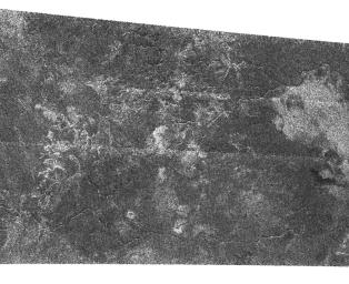
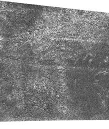
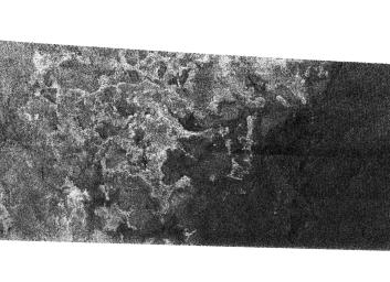
Saturday, September 17, 2005

The End Part II

Okay this really is the last post. I just want to nip in the bud, right here, right now, shutting down this site was my idea. No one, and I mean no one, asked me to shut it down. I received some comments regarding some top level manager's opinion on my recent posts on the T7 issues (which I should point were temporary and have been fixed). It was a mistake for me to even discuss them here, even in the vague manner I tried to convey, and their disapproval was brought to my attention. This issue scared me. It was fun when this site was just a small group of people who wanted to hear the latest from Cassini. But if I need to be concerned about what I write, then it becomes less fun. I love what I do, I can't imagine myself doing any better at this point in my life, and I will not jeopardize it for a blog. I'm sorry, but I won't. And rather than look over my shoulder and wonder if what I just sent is kosher with everyone who are higher up than me, I'd rather just end this page. I apologize to all those who have come to rely on this page. I really do. Don't stop caring about the Cassini mission just because I'm not here to blog about it.

Now, that's not to say I am completely going away. Last night, I decided rather than give up here and do nothing with volcanopele.blogspot.com, I will just change the format. I have had this novel, essentially in my head for 5 years now, waiting for me to actually commit it to paper. I've decided to write it here on this blog. I'm not sure how this will work but I think it will be an interesting experiment. Based on similar projects on Blogger, I will post a segment of the novel every few days, once a week or so, on a post. It could be a chapter, it could be more, it could be less. I personally like that concept. So I am going to give it a try. So on September 24, this blog will be replaced by "Afterword". I hope some of you come back for that.

Friday, September 16, 2005

The End

This will be the last post of this blog. I know a lot of you have come to rely on this site for information on the Cassini mission, but it appears that I will no longer be able to continue posting here. Ironically, this site was killed by its success. This site was read not only by people in the public, but by those in the Cassini project as well. I knew full well of this, but apparently I crossed a line with one of my posts last week, and they called me (litterally) on it. This site was only going to stay up as long as I got something out of it and you did too. Now, this site has become a lot less fun. So, effective immediately, I will no longer be posting on this blog. I will probably post occasionally on the Unmanned Spaceflight.com forum, but will likely become a lurker. I will keep the site up for the next week, when I will then shut it down for good :-(

New Titan Image: Canyonlands on Titan


The Cassini RADAR team released this view of Titan taken last week during the T7 flyby. This cutout from their SAR noodle is located near 55 degrees South, 7.5 degrees West and is approximately 300 km long. Unlike the previous image, the channels in this region consist of long valleys (up to 200 km long and 200 meters deep) that have only a few tributaries. These channels are more akin to river systems on earth rather than the arroyos seen in the T3 swath and in the previous image.

New Titan Image: Titan's Rain Drains to the Plains


This is the second of three views released by the Cassini RADAR team showing portions of the RADAR SAR swath returned last week. This portion is from south central Tsegihi near 48 degrees South, 14 degrees West. This view extends 240 kilometers from left to right. At top, you can see a deeply incised channel flowing from a region of bright, rough terrain down to darker, smoother material. This fits with the view that methane rains wash material from the bright highlands down to darker plains. Near the bottom of the image, there is a branching network of channels, with the widths of the channels varying. These properties are suggestive of rainfall run-off channels rather than river networks.

Still, note how well this liquid has eroded these channels. These are quite deeply incised, suggesting either that the liquid efficiently erodes the bedrock, or these channels have been active for a good percentage of geologic time.

New Titan Image: Shoreline on Titan?


The RADAR team on Cassini has released some of their SAR swath taken on September 7. I will post my comments on all three cut outs. This portion is near the very end of the part the were able to get back. The second half was lost. This portion shows a possible shoreline in the central part of the dark albedo feature known as Mezzoramia. On the left, you can see terrain that is suggestive of erosion by liquids, with alcoves and scarps. At right, the surface is quite dark suggesting that the area is much smoother than any other place so far looked on Titan by Cassini RADAR. Many of the bright features that bound this terrain are similar to shoreline terrain on Earth.

This portion of the swath is from 66 South, 356 West in central Mezzoramia. This portion is 330 km wide and 175 km tall.

Cassini Significant Events for 09/08/05 - 09/14/05

Haven't mentioned one of these in a while, but this week's Cassini Status update is now online. Regarding the mishap during last week's Titan flyby:
A significant amount of science data was lost during the recent Titan flyby as a result of an operational problem at the DSN tracking station, and a software error on the spacecraft. The software error was the larger contributor of the two causes, and the data loss resulted from an improperly set flag preventing the spacecraft from writing to or reading from the A side of the solid state recorder, so the result was performing the encounter with only half of the expected data storage volume. Commands will be sent on September 15 to reset the flag to its proper value, and normal operation is expected after this. The nature of the code error is now fully understood and has been reproduced in the spacecraft test bed. A decision will be made in the near future whether to correct the flight code or to implement workarounds to prevent the conditions that led to execution of the faulty code.

These problems led to the loss of all data after 1 minute prior to closest approach (because the "B" recorder was full at that point) as well as our high resolution mosaic, VIMS' medium resolution mosaic, and the RADAR inbound altimetry data. We did, however, obtain our global mosaic (a portion was released publically earlier this week) and RADAR received a portion of their SAR swath over central Tsegihi, Mezzoramia, and some features a little farther to the east.

Wednesday, September 14, 2005

New Telesto Image: Squinting at Telesto


CICLOPS has released this processed view of Telesto, taken on August 1 from a distance of 768,000 km. From that distance, the 24-km wide Telesto appears as nothing more than a blog of light with no discernable features or shape. Believe it or not, this qualifies it as one of the best images of Telesto thus far (Voyager's best image was ~ 5km/pixel) But, fear not, better images of Telesto are coming. Cassini comes within 9800 km of this small, trojan satellite on October 11, 2005. This will be one of the closest flybys of a small satellite during the tour. At closest approaches, images with a resolution of 56 m/pixel are possible (~425 pixels across Telesto's disk).

Tuesday, September 13, 2005

Off-topic: Cassini finally sees spokes in Saturn's B-ring


Not exactly satellite-related, but as has been alluded to on a few discussion sites in the past week, the Cassini Imaging team announced today that they had finally observed the spokes, first seen by Voyager but had not been seen by Cassini. The spokes appear to be bright wispy features on the B-ring in the above image and in the images released today. These images are of the unlit side of the ring, so the B-ring appears dark due to its opacity and the C-ring, at lower left, appears bright. Saturn's limb can be seen toward the upper left corner. Pretty neat stuff.

New Titan Image: Monitoring Fensal-Aztlan


CICLOPS has released this mosaic of the Fensal-Aztlan (formerly known as the "H") region on Titan. Fensal is the northern branch of the "H". Fensal has some subtle brightness variations and has quite a few bright spots, or "islands", dotting the region. Their distribution appears to be more scattered than similar sized bright spots in Shangri-la, west of Xanadu. There, the spots were clustered into several "archipelagoes" and aligned in a similar fashion, usually east-west. The spots in Fensal don't seem to have a prefered orientation. A few larger bright spots can be seen in Fensal, including Bazaruto Facula on its eastern end.

Aztlan, the southern branch of the H plus the dark region surrounding Elba Facula to the east (not in this particular crop), has far fewer smaller islands, but does have several large islands, including Sotra Facula, a 240 by 120 km sized bright feature just right of center in the lower left frame, and Coats Facula, a smaller island to the east of Sotra.

This mosaic is just 4 frames within a larger, 20-frame mosaic to be released later. This mosaic was taken during last week's T7 encounter.

Monday, September 12, 2005

DPS Titan News

Emily Lakdawalla at the Planetary Society has posted on her blog quite a few notes from the Titan DPS talks. Unfortunately, not much is news to me so it is rather difficult for me to remember what has been publically mentioned and what is new. It is a great read and and I definitely recommend checking it out.