Saturday, March 12, 2005

Planetary Society Looks at New Enceladus Images

The Planetary Society has an article on their website by Emily Lakdawalla examining the Enceladus images taken during the last month in flybys on February 17 and March 9. A pretty good overview of the features seen on Enceladus.

Friday, March 11, 2005

Press Release: Cassini Images Reveal and Active, Earth-Like World

In conjunction with today's Nature issue, CICLOPS has released a press released describing the results of ISS observations of Titan through January. Among the highlights is the discovery of several bright and dark rings which maybe related to impact structures. One in fact was confirmed as an impact structure by RADAR last month. Also, the ISS team notes several dark, criss-crossing bands which maybe due to tectonism, and dark curvilinear structures which maybe large-scale, runoff channels or rivers.

Update: !$#%@ Spaceref.com has the press release posted, not unexpected. However, the image they used as a thumbnail for the release, is from VIMS. !#^&@

Raw Images of the Day

Thursday, March 10, 2005

Press Release: Cassini Images Discover a Windy, Wavy Titan Atmosphere

CICLOPS has released another press release, this time on Titan's atmosphere, in conjunction with the ISS paper on Titan in Today's issue of Nature. The two key results include the confirmation of that Titan's atmosphere revolves faster than the solid body, based on cloud tracking measurements, and that Titan hazy stratosphere of more than one haze layer, though the effect maybe due to density waves in the atmosphere caused by disturbances lower in the atmosphere.

Enceladus Raw Images

As Raw images from the Enceladus flyby that took place last night roll in on the JPL Cassini Raw images page (and later on the CICLOPS page), I will post them here. They should start to come in within the next half hour.

New images posted...

Update 2: Feel free to discuss the images in comments...

Update 3: Changed some links to CICLOPS versions without truncated lines.

New Tethys and Enceladus images

Some new Tethys and Enceladus images are now online, including the highest resolution view of Tethys:

Wednesday, March 09, 2005

New Map of Titan

Titan Map Thumb

One of the images released today is my pride and joy, a map of Titan using images from before SOI, T0 (July 2004), Ta (October 2004), and Tb (December 2004). The map covers Titan's entire surface from 34 degrees North Latitude to the south pole. The map represents the best global coverage to date of Titan. Each images has been sharpened and empirically photometrically corrected to best bring out surface features (though it does a number on clouds...).

If you want to use this map for planetarium software or Titan24, keep in mind that it is cropped at around 34N. To create a map for such software, in a photo editing program like Photoshop create a blank image (either with a black or medium grey background) with a width equal to that of the non-grided map version you are using (full, half, or quarter) and a height equal to half the width. Paste this map (within the teal boundaries) on the blank image you created and make sure the bottom of the map is flush with the bottom of new image since the bottom of the released map is the south pole. You should then have a full map of Titan (even though there is no data north of 34N). You can also try pasting the RADAR data on this map, but that's beyond my skills to tutor.

Scrutinizing Titan's Surface

Great Britain

CICLOPS has released a montage of images showing interesting surface features found during the Ta and Tb flybys. One of the images, shown above, shows a feature informally called Great Britain due to its resemblance of the earthly island. This feature is complete surrounded by dark material. Dark channels cross cut this feature, perhaps similar to channels seen near the landing site. Speaking of the landing site, one of the frames in the montage does show the best orbital view thus far of the landing site. Other frames include a detailed look at the foundary between bright and dark terrain to the east and south east of Great Britain, sapping features southwest of Great Britain, and interesting features in the "Aegean Sea" region.

Sharpened View of Titan's South Pole

T0_SPOLEB

CICLOPS has released as part of their image release set for the Titan Special Issue in Nature published today a processed view of Titan's south pole taken during the T0 distant encounter on July 2, 2004. This is the same view released shortly after the encounter however in the subsquent months, procedures were developed to enhance surface features seen by ISS for easier interpretation. However, this does cause problems for clouds so the dark "shadows" seen near them are processing artifacts, not shadows caused by sunlight.

Update: CICLOPS page isn't up yet. Try the Photojournal for now.

Tracing Features on Titan's Surface

faults

CICLOPS has released a montage of images showing channel or fault-like features seen during the July 2, 2004 distant encounter of Titan by Cassini. The images show features that could possibly be interpreted as large scale runoff channels or tectonic faults exploited by surface liquids. One frame shows a possible impact crater in the bright terrain. Some of these features will be investigated again later this month and in mid-April in two flybys during which the sub-Saturnian hemisphere will be examined.

Update: CICLOPS page isn't up yet. Try the Photojournal for now.

Astrobiology Magazine: The Missing Methane

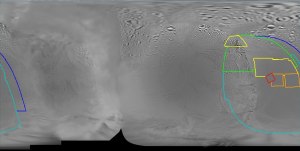
As a followup to one of my first posts on this blog, Astrobiology Magazine has posted the second part of a four part series of an edited transcript from a talk Jonathan Lunine gave at the NASA Director's Telecon in late January. A lot of useful information there, particularly for those looking for a wrap-up of the Huygens mission and the Ta and Tb flybys.

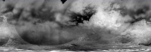
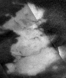
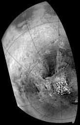
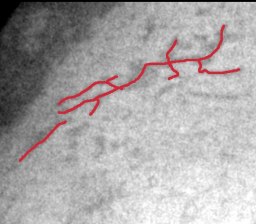
As the title implies, this article is mostly about Titan's methane: how it got there, what happens to it in the atmosphere, how both the release and rainout processes affect the surface. Quite an interesting read.

For those who can't stand edited transcripts, if you have RealPlayer, why not listen to the talk? Or for those who don't have the time to read the edited transcript and just want the nuts and bolts, read my summary.

Thanks to imran at the MER forum for the heads up.

Tuesday, March 08, 2005

Enceladean Names


Here is an image I put together from a released image from the last encounter with feature names added. This is the area that will be covered tomorrow. Hopefully this will help facilitate discussions, like being able to reference points to identify a feature.

Enceladus-1 Mission Description

NASA has released the mission description document for tomorrow morning's Enceladus-1 flyby. None was released for the flyby last month since technically it was a non-targeted flyby despite having a "targeted" flyby distance. The document contains information on Enceladus, Enceladus science questions, goals for this flyby, graphics showing planned observations, and timelines for data acquisition and playback. Among the highlights:
  • The mass determination from the Rev 3 encounter found that the internal rock-ice ratio is higher than previously estimated
  • No ammonia has been detected at Enceladus in infrared spectra
  • CIRS measurements on the day and night sides of Enceladus will map surface temperatures to determine thermal inertia. If active sources are present, CIRS will determine their spatial distribution and energy output. CIRS will search for spectral signatures on the surface and in plumes (if present) to determine composition.
  • ISS will perform meter-scale resolution imaging to determine geological structures and investigate the satellite's history.
  • RADAR scatterometry of the surface will determine roughness at cm scales. Radiometry will probe the energy balance of Enceladus.
  • UVIS will make UV maps of the surface of Enceladus to understand surface composition and will look for emission features suggestive of a tenuous atmosphere.
  • VIMS will investigate the identification of minerals and other materials on the surface, and will perform mapping of the abundance and grain sizes of surficial materials.
  • MAPS instruments will examine the particle environment at ~500 km from the surface to determine the nature of material coming off the surface and the relationship between the satellite and the E-ring, and the satellite and its immediate magnetospheric particle environment.
  • Data from the inbound, "dayside" part of the flyby will be played back tomorrow morning, between 9:30 and 11:00 am MST. Data from the outbound, "nightside" part of the flyby and from the Tethys non-targeted flyby will be played back Wednesday evening between 7:23 and 11:00 pm MST.

Raw images of the Day

Enceladus Rev 004 Coverage Map

E04 Coverage Map

CICLOPS has released a coverage map for ISS images taken during today's Enceladus encounter. This flyby is farther east than last time, covering much of terrain seen in lower resolution imaging (~1.5km/pixel) during last month's encounter. Targets of particular interest include fractures along the eastern side of Diyar Planitia, rugged terrain south of Diyar Planitia seen in profile last month, and the curious ridges of Harran Sulci (the western end seen in the upper left cross cut by two, north-south parallel fractures).

Update: I've changed the title link for this post to the Photojournal page for this image. I guess this wasn't meant to be released today... or at least not this morning. So if you've been having problems with the title link, try it now.

Update #2: I've changed the title link back to the CICLOPS page now that it is up.

Update #3: I should note that the coverage outlined here has been trimmed by illumination angle (how far or close a location is to the sub-solar point) and emission angle (how far or close a location is to the limb), so there will be additional coverage along the edges of the outlined coverage.

Monday, March 07, 2005

This Week's Encounters

Cassini is currently near periapsis on its fifth orbit of Saturn (rev 04), and while there will be no Titan encounter this time around, there will be a few very intreguing icy satellite flybys, not the least of which is the targeted 500 km flyby of Enceladus early Wednesday morning. This encounter comes on the heals of last month's 1000 km flyby which revealed a variety of terrains that were part Europa, part Ganymede, and part Miranda with what appear to be tectonic grabens and cryovolcanic flows. As seen at the MER Forum, Bjorn Jonsson has a few graphics showing the areas that will be visible to Cassini on this pass. This area is to the east of the region covered last month.

In addition to the Enceladus close flyby, there is also a non-targeted Tethys flyby. At close approach, Tethys' Ithaca Chasma will be clearly visible to Cassini near the Tethyan terminator.

New Rhea Image: Rhea's Crescent

Rhea's Cresent JPEG

CICLOPS has released a new view of Rhea at high phase angle. Rhea is Saturn's second largest moon and has one of the oldest surfaces of the major Saturnian satellites. Not quite sure, but I believe the crater along the terminator near the bottom is Izanagi.

Sunday, March 06, 2005

Cassini Sees Mimas and Janus Mutual Event

Cassini captured another mutual event in which Mimas went in front of Janus from Cassini's perspective. Janus is one of Saturn's smaller satellites, only 200 km across while Mimas is 400 km across. A few weeks ago, Cassini captured a mutual event with Dione moving in front of Rhea from Cassini's perspective.

The entire series of images can be seen at the Cassini Raw Images, just click on the Title link for this post, tap on Search Image without selecting search paramters (or search for Narrow Angle images of Janus). For the actual eclipse shots, go here and here.

If anyone makes an animated gif of this, let me know.