Friday, May 06, 2005

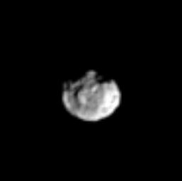
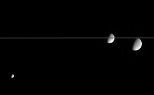
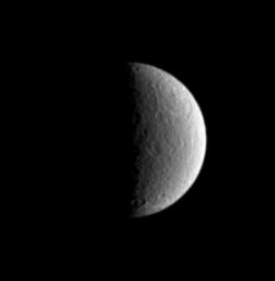
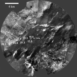
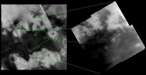
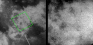
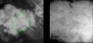
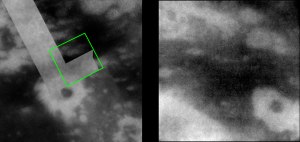
Cassini Significant Events for 04/28/05 - 05/04/05

JPL has posted online the significant events report for the last week. Highlights:
  • New reference trajectory released that includes the Enceladus-2, Tethys-1, and Hyperion-1 tweaks. Mostly an internal development.
  • OTM#24 was successfully completed last Thursday. This is one of only three burns between the Titan flyby last month and the Enceladus flyby on July 14. The next burn won't take place until July 8.
  • The first radio ring occultation of the Cassini mission took place this past Monday. This occultation ran from 9:30 pm that day till 3 am the next morning. Results from this occultation are expected next week, according to this report.
  • Cassini RPWS detected the radio burst from a coronal mass ejection that erupted on the sun on Monday. The particles from this blast are expected to reach Saturn and Cassini on May 23.

New Hyperion Image: Hyperion's Nose


CICLOPS has released one of the best images so far of Saturn's chaotic moon, Hyperion. This view shows several craters along with a large peak on one side of Hyperion. This image has a resolution of 11 km/pixel (though the images has been magnified by 3x) and was taken in March.

Still waiting on Tethys images?

I noticed a spike in website traffic today. I'm sure much of it has to do with the DISR and ISS images released yesterday but since site traffic spikes like today seem to be correlated with distance to Saturn and/or Titan, I am also guessing some of you are here for Tethys images. Well, they haven't shown up yet, not even at the JPL Raw images page. Rest assured once they show up there I will post them here.

UPDATE 05/05/2005 10:30am: I'm starting to get pessimistic about these images showing up, unfortunately. But hey, at least there are plenty of ring images to look at.

Update 05/06/05 11:49 am: Unfortunately these images appear to be lost. The images in the previous observation of the outer A ring were not as compressed as expected, causing ISS to go over their limit in data allocation for that particular playback period. This cut off the end of the outer A ring observations and the ISS Tethys observations (but not the VIMS Tethys observation that ISS was riding along with). I hope this explains what happened. As you can imagine, I am very disappointed in this. The computer I work on here at the lab is named "Tethys" and I was hoping to have a nice mosaic of said moon for a background image...

Thursday, May 05, 2005

Yesterday's Astronomy Picture of the Day


Yesterday's Astronomy Picture of the Day (a website maintained by Robert Nemiroff & Jerry Bonnell on the Goddard Space Flight Center website) is a wide-angle view produced by amateur Fernando Garcia Navarro using Cassini images taken in February. This color view shows Saturn's rings edge-on, an event that occurs on earth every 15 years or so. This is also the kind of view of Saturn that would be seen from Saturn's larger moons, like Titan. Often in artist renderings of Titan, the artist can't fight the temptation to show Saturn with its rings, which is not how Saturn would be viewed from that satellite. Still, without the rings, I think this is a great view of this majestic planet.

New Cassini Image: Amazing Icy Moons


CICLOPS has released this processed view of Mimas, Dione, and Rhea (from left to right) in the same narrow angle field of view. This alignment of moons was captured on March 15, 2005. The trailing hemispheres of each moon are on display here. For Dione and Rhea, this includes their respective wispy terrain near their limbs. An interesting cross section of the edge-on rings here can be seen as it bisects Dione.

Wednesday, May 04, 2005

Planetary Society Article on Titan Imaging Correlation

The Planetary Society website has a new article by Emily Lakdawalla comparing the RADAR SAR swath from T3, the ISS observations from T4 and T5, and the VIMS observation of the 80-km crater from T5. A very good read and a recommendation from me (even includes a reminder for something I need to get done tomorrow, the part about the features needing names). The author looks at the 80-km crater, combining all three data sets. By combining all three data sets, a more complete understanding on the geology of this crater can be achieved. The other comparison is of the two "bays" seen along the northern margin of the "H" feature. These two "bays" show that areas of "cat scratches" are dark in ISS images. However, the ISS dark regions are usually slightly larger, suggesting that RADAR maybe seeing through the substrate between the dunes while ISS sees the substrate and the dunes as the same "dark".
Also, the Planetary Society website has an article on the latest DISR mosaics released on Sunday and Monday.

Phoebe Nature Papers

Two papers have been published in the journal Nature this week with results from the VIMS instrument from the June flyby of Saturn's moon Phoebe, as well as a paper by Torrence Johnson and Jonathan Lunine on the history of Phoebe. Links and a brief synoposis of results follow.
  • Clark R. N., et al. Compositional maps of Saturn's moon Phoebe from imaging spectroscopy. Nature, 435. 66 - 69 (2005).
    • Phoebe is one of the most compositionally-diverse bodies in the solar system
    • Compounds detected by VIMS vary in abundance and grain size at different locations
      • Water ice
        • Distributed throughout surface, highest abundance in south polar region
        • Crater interiors in highest resolution data have lower water ice abundances compared to their surroundings, suggesting that ice is less abundant in the deep subsurface, though small crater do appear to excavate ice, suggesting an ice-rich layer near the surface
      • Bound Water
        • Features at 1.5 and 1.95 microns
      • Bound CO2
        • Absorbtion at 4.26 microns
        • Linear structures in highest resolution data seen at this wavelength, not seen at 1 micron reflectance
      • Fe2+-bearing minerals
        • Absorption at 1 micron is broad (1.1 microns in width)
        • More consistent with olivines and phyllosilicates than with pyroxenes
        • Weak OH-stretch/metal combination features at 2.2 and 2.3 microns are consistent with an interpretation that the Fe2+ minerals are phyllosilicates
      • Cyanide compounds
        • Not seen elsewhere in solar system
        • Absorption at 2.42 microns best fits Potassium ferrocyanide trihydrate - K4Fe(CN)6*3H2O
        • Mainly seen in equatorial regions
        • Absorption later found on the dark side of Iapetus and Comet Borrelly
      • Organics
        • Weak features at 3.3 microns
        • CH-stretch near 3.3 microns
        • No absorptions seen between 3.4 and 3.7 microns
        • 3.3 micron feature maybe due an aromatic or cycloalkane hydrocarbon (not long chain aliphatics)
        • No structures associated with pyrene or anthracene
      • Nitriles (CN)
        • Absorption features at 4.50 and 2.54 microns, and near 3.3 microns
        • Possibily due to alkane molecule with a nitrile group attached
        • Feature at 3.62 microns maybe due to HCN
    • Abundance of carbon likely results in Phoebe's low albedo, other minerals have less effect
    • The broad Fe2+ absorption also seen in Saturn's rings, but not the organics and cyanides
  • T.V. Johnson and J.I. Lunine. Saturn's moon Phoebe as a captured body from the outer Solar System. Nature, 435. 69 - 71 (2005).
    • Density of Phoebe = 1.63 gm/cm3
      • Still well above density of Mimas, Enceladus, Dione, Tethys, Rhea, and Iapetus (1.3 gm/cm3)
    • Assuming Phoebe is made of the same material as Triton and Pluto, both with densities of 1.9 gm/cm3, Phoebe would have a porosity of 15%
    • Assuming most of the Carbon in the protoplanetary disk was tied up in oxygen (but not all), a Phoebe compositional identical to Pluto and Triton emerges

New Rhea Image: Big Basin


CICLOPS has released this processed view of Saturn's moon Rhea. In this view, the large impact basin, Tirawa, can be seen to the upper right as well as a number of smaller craters. This view primarily shows the trailing side of Rhea.

This image has a resolution of 10 km/pixel but has been contrast enhanced and magnified 2x to bring out surface detail. The image was taken from a distance of 1.7 million kilometers.

Tuesday, May 03, 2005

New Saturnian Satellites

Okay, over the next few weeks it will get very confusing as to how many moons there are of Saturn. So lets start from before today. Before Cassini, there were 31 satellites. Cassini discovered two moons between Mimas and Enceladus, another trojan of Dione, and three satellites near the F ring. That brings us to 37 satellites. Since this time, the three F-ring moons have not been recovered and thus have not been given names like the other three Cassini moons. So lets subtract them from the list, leaving us with 34 moons.

Now add 12. David Jewitt and Scott Sheppard, the most prolific satellite discoverers of all time, today announced the discovery of 12 more outer satellites of Saturn. From the release:
The satellites were discovered on December 12, 2004 using the wide-field SuprimeCam camera on the 8.2-meter diameter Subaru telescope on Mauna Kea. They were followed up in January, February and March 2005 using Subaru and the nearby 8-m diameter Gemini North telescope.

The satellites were formally announced by the International Astronomical Union on May 3, 2005. The orbital elements are given in Table 1. All but one (S/2004 S11) orbit Saturn in a direction opposite to the planet's spin. These retrograde orbits are a hallmark of an origin by capture. The new moons range in diameter from about 3 km to 7 km, assuming a surface albedo of 4%.
This brings the total to 46. Certainly more on the way...

The Following table provides some information on the newly discovered satellites, such as orbital information (borrowed from Scott Sheppard's site):
Name  Semimajor axis i e km Year
S/2004 S07 19800000 165.1 0.580 5 2004
S/2004 S08 22200000 168.0 0.213 5 2004
S/2004 S09 19800000 157.6 0.235 5 2004
S/2004 S10 19350000 167.0 0.241 5 2004
S/2004 S11 16950000 41.0 0.336 5 2004
S/2004 S12 19650000 164.0 0.401 5 2004
S/2004 S13 18450000 167.4 0.273 5 2004
S/2004 S14 19950000 162.7 0.292 5 2004
S/2004 S15 18750000 156.9 0.180 5 2004
S/2004 S16 22200000 163.0 0.135 5 2004
S/2004 S17 18600000 166.6 0.259 5 2004
S/2004 S18 19650000 147.4 0.795 5 2004

June 2005 Issue of the Journal Icarus

The latest issue of the journal Icarus is now online for subscribers. Papers that are germane include:
  • "Spectrophotometry of the small satellites of Saturn and their relationship to Iapetus, Phoebe, and Hyperion" by B.J. Buratti, M.D. Hicks and A. Davies
  • "Titan's internal structure inferred from a coupled thermal-orbital model" by Gabriel Tobie et al.
  • "Carbon monoxide fluorescence from Titan's atmosphere" by M.A. López-Valverde, E. Lellouch and A. Coustenis
  • "Impact cratering on Titan II. Global melt, escaping ejecta, and aqueous alteration of surface organics" by Natalia Artemieva and Jonathan I. Lunine
  • "Sea-surface wave growth under extraterrestrial atmospheres: Preliminary wind tunnel experiments with application to Mars and Titan" by Ralph D. Lorenz et al.
  • "An equal-area map projection for irregular objects" by M.G. Berthoud

Spacedaily.com Titan Article

This week's "In the Stars" column by UPI Science Writer Phil Beradeli covers the recent INMS findings from last month's T5 encounter. Sounds tame enough, except he envokes life on Titan to explain the diversity of hydrocarbon ions found by INMS. Of course, no such drastic explaination is really needed. Yes, it was surprising to find so many complex hydrocarbons that high up in the atmosphere. It is not as if these chemicals are unexpected for Titan's atmosphere, the photochemistry of Titan's haze layers (as Solar UV light breaks down methane and other hydrocarbons and these radicals then recombine into a number of combinations) would surely make quite a stew. But to invoke life is unneeded IMHO.

If that wasn't enough, the author then mentions surface features seen by Huygens and mentions that these might be artificial constructions. He mentions that of course this feature and the INMS results, can logically be explained by either natural or non-biological processes, but that is still not impossible.

Then again it is highly unlikely, but not impossible that pigs will fly and that I will be given the title of emperor of Earth.

New Epimetheus Image: Rubble Moon?


CICLOPS has released this low-resolution, processed view of the small, inner moon, Epimetheus. Epimetheus was seen at much higher resolution at the end of March. This images was taken from a distance of 1.8 million kilometers and has a resolution of 10 km/pixel though the images has been magnifed 2x to improve visibility.

Monday, May 02, 2005

More New DISR Mosaics


The DISR team has released three additional mosaics showing the ground track of the Huygens spacecraft over the surface of Titan three months ago.
  • The first mosaic shows the landing site region from an altitude of 15 km, with the ground track of the probe from 49 km downward. The coverage shown in this mosaic is similar to that of the mosaic produced by Rene Pascal. Personally, I prefer his mosaic since it is not nearly as smoothed out. Yes, you still see some of the noise in his mosaic and it has not been as geometrically controlled as the DISR team's mosaic, but maintaining the fidelity of the constituent images does have its uses.
  • The second mosaic, shown above, simulates the view from 4 km, with the ground track drawn in. This view shows the features on the nearby bright island as well as the bright, wispy features in the dark material. I am still puzzled by these wispy features.
  • The third mosaic shows the landing site region from an altitude of 500 meters, with the ground track of the probe drawn in. The ground track at this scale is quite intriguing. Previously, it had been mentioned that the probe appeared to turn north in the last few kilometers, but based on an early animation of this motion, I had thought the probe turned back to the way it came. This graphic demostrates that. The probe started to slow down its forward motion at around 12-13 km, then started to turn around at 7-8 km in altitude. It then headed in the direction from whence it came, and landed very close to where it was overhead at 13 km. This mosaic is on a slightly higher scale from one of the mosaics released yesterday, showing gully-like features around small outcrops within the dark terrain.
The grey circles in the first and second mosaics show the outlines of the next mosaic.

Today's Tethys Non-Targeted Encounter

While we are entering a lull in satellite encounters for Cassini with the beginning of the ring occultation sequence of the Cassini Tour, this doesn't mean that there is nothing fun to do. On this orbit, Cassini will come within 50,000 km of Tethys. Tethys was seen on orbits 0A, which provided an excellent view of the freak crater Penelope, and on orbit 4, which provided great views of a region southeast of Odysseus basin and of the central portion of Ithaca Chasma.

On this orbit, the view near close approach, as simulated by JPL's Solar System Simulator, will show the south polar region of Tethys, a region very poorly seen by Voyager and Cassini. One interesting target in this region only seen as far as I know in Cassini images as I don't seen it in any Voyager maps, is the so-called "South Polar crater". This crater is not at the south polar but is in the far southern latitudes. This crater can be found in several released and raw images (1, 2 (near the left limb), and 3). Also, the southern terminus of Ithaca Chasma could be in view, but I can't be certain.

Closest approach is at 3pm MST today. Given the inability of the JPL Raw images page to have ALL the images returned, I can't guarantee when or if you will see them, though I would suspect sometime tomorrow morning.

UPDATE: 05/02/2005 1:15 pm: Turns out the south polar crater has a name, Melanthius, a large crater at 62S, 210W. I didn't realize this since it never shows up on any Voyager era maps and the map with names I do have doesn't have Melanthius on it, even though this is an approved name. Another crater that should show up, at 60S, 270W is Antinous, again this crater doesn't show up on the maps I have. I want to thank Phil for the info on this. I am mildly disturbed that there are feature names mentioned in the atlas for these moons that aren't on the maps within said atlas ("The Compact Nasa Atlas of the Solar System").

New Titan Image: Complex ‘Anti-greenhouse’


In addition to all these wonderful images of Titan surface ;-D, CICLOPS has also released this view of Titan's atmosphere in color. This color view spectacularly shows the high altitude hazes (in blue) and the complex structure therein, and the orange haze below. This image was taken shortly after the T4 flyby on March 31. The images used for this color view were taken shortly before the wide-angle camera images used in a movie released earlier. The hazes seen here are made mostly of hydrocarbons derived from photochemically-altered methane, like acetylene, benzene, and ethane. These particles preferentially scatter light at shorter wavelengths like blue and ultraviolet, making them appear blue here.

Lower down, from the caption:
Lower down in the atmosphere, the haze turns into a globe-enshrouding smog of complex organic molecules. This thick, orange-colored haze absorbs visible sunlight, allowing only perhaps 10 percent of the incident light to reach the surface. The thick haze also is inefficient at holding in and then re-radiating infrared (thermal) energy back down to the surface. Thus, despite the fact that Titan has a thicker atmosphere than Earth, the thick global haze causes the greenhouse effect there to be somewhat weaker than it is on Earth.
This color view was taken from a distance of 9,500 km and has a resolution of 400 meters/pixel.

New Titan Image: Bright-Dark Boundary Close-up


CICLOPS has released this newly processed mosaic of images taken during the April 16 T5 flyby of Titan. This mosaic shows features along the northern bright/dark boundary of the "H". From the caption:
Prominent in this mosaic is the boundary between bright and dark terrain. The outline of this boundary in some places suggests fluvial activity, particularly along the margin of the dark region that extends north near the top center of the mosaic. Along its western edge, long, dark curvilinear features can be seen running from the bright area into the dark area, similar to other channel like features seen in previous flybys.

The RADAR SAR swath taken during the February 2005 flyby of Titan covers much of the region shown on the right, particularly along the northern and western edges of the mosaic. For example, the bright oval-shaped feature (34-km across) near the right corner of the mosaic corresponds to the bright feature seen in the lower left corner of a previously released RADAR SAR image from February (PIA07368). Comparing the same features as seen by different instruments will be important to understanding how these features formed. Furthermore, it will help to constrain what exactly each instrument is detecting (surface roughness vs. brightness, surface vs. subsurface, topographic effects, etc.).

The mosaic at right is centered on 11 degrees North, 27 degrees West; north is up. Each frame consists of 5 images that have been added together and enhanced to bring out surface detail and to reduce noise, though some camera artifacts remain. These images were taken using with a filter sensitive to infrared wavelengths near 938 nanometers, considered the best ISS filter for observing the surface of Titan. This view was acquired from distances ranging from 57,000 to 46,000 kilometers. The pixel scale ranges from 670 to 550 meters per pixel though the actual resolution is likely to be several times that.

New Titan Image: Jumbled Terrain


CICLOPS has released this newly processed, high resolution view of Titan's surface taken during the April 16 flyby of Titan. This view shows an area on the western side of a bright feature nicknamed "Java". This region is characterized by a complex pattern bright and dark terrain, with dark patches ranging in size from 20 to 40 km in diameter. These spots appear more complex than the putative crater-related dark spots highlighted in another release today. The RADAR SAR swath from T3 in February covered parts of this area on their far eastern end so some joint investigation of this region is possible.

New Titan Image: Channels on Titan


CICLOPS has released this newly processed, high resolution image of Titan. This image shows apparent branching channels on the eastern end of a large bright feature nicknamed "Sumatra". This image was taken from a distance of 40,000 km and has a pixel scale of 470 meters per pixel.

New Titan Image: Dark Spots on Titan


CICLOPS has released this newly processed view of bright and dark terrain on Titan. This particular view, taken during the April 16 flyby of Titan, shows a 20-km wide dark spot on Titan, that maybe impact-related. From the caption:
Interestingly, a smaller (~20 km in diameter), dark circular feature can be seen within a bright annulus, similar to the larger dark spot associated with the RADAR crater. However, ISS sees only brightness variations and without topographic information whether this feature is also an impact crater cannot be determined conclusively. The Visual and Infrared Mapping Spectrometer (VIMS), which is sensitive to longer wavelengths at which Titan's atmospheric haze is less obscuring, observed this area simultaneously with ISS, so those data, and perhaps future observations by Cassini's RADAR, may help to answer the question of this feature's origin.

The image at right consists of five images that have been added together and enhanced to bring out surface detail and to reduce noise, though some camera artifacts remain. These images were taken using with a filter sensitive to infrared wavelengths near 938 nanometers, considered the best ISS filter for observing the surface of Titan. This view was acquired from a distance of 33,000 kilometers. The pixel scale of this image is 390 meters per pixel though the actual resolution is likely to be several times that.

New Titan Image: The Angular Bright Spot


Update: 05/26/2005: Those of you looking for the bright spot announced by VIMS and ISS yesterday (as I can see by how many people are coming to this page from google), you want to know about a different bright spot from this one. Check out my blog post on that discovery for more info.

CICLOPS has released this high resolution view of Titan's surface taken during April 16's T5 flyby. This image was taken from a distance of 43,000 km and has a resolution of 510 m/pixel. Since I can't beat my own writing, from the caption:
The 80-kilometer wide bright spot seen in the upper right portion of the image at right was first seen in images taken during a distant encounter of Titan shortly after Cassini's Saturn Orbit Insertion burn in July 2004. In images taken in March and now in the most recent flyby, this spot was shown to be roughly circular but the new, higher-resolution images reveal surprisingly angular edges. The angular margins suggest that they have been influenced by tectonic processes (for example, faulting). The sharp western margins and more diffuse bright material off the eastern margin are consistent with bright features seen within dark terrain in the region of Titan observed during previous flybys late last year and in February. The west-east nature of these features is consistent with "wakes" being formed through aeolian, or wind, activity.
The lower portion of the image shows the southern boundary of the dark region known as the "H".

Sunday, May 01, 2005

New OFFICIAL DISR Mosaics

The DISR team has released two new mosaics using images from low altitude, as opposed to the mosaics produced by Rene Pascal which use image from higher altitude, which have lower resolution, but higher areal coverage. The first mosaic, in stereographic projections, uses images from all three cameras on DISR and simulates a view from a fish-eye camera looking down. This mosaic clearly shows the "island" to the north and the large, very dark region to the south. The second mosaic, in gnomic projection, uses the lowest altitude MRI and HRI images and show the best coverage near the landing site (marked with a cross). Because Huygens started moving to the north and west in the last few kilometers of its descent and DISR's HRI doesn't look straight down, there is no high resolution image of the landing site from above. However, this mosaic shows nearby features like the gullies to the west (again assuming that north is up, which isn't guaranteed since there is no caption).